
The importance of a Geological Assessment

Why Geological Assessments Are Essential for Safe and Cost-Effective Construction Projects
Understanding the ground beneath a proposed development site is critical for safe, compliant, and cost-effective construction. A Geological Assessment provides the baseline knowledge required to identify potential geo-hazards, design targeted ground investigations, and satisfy planning requirements.
At Northpoint Geotechnical, our engineering geologists carry out comprehensive assessments that combine desk-based research with intrusive investigations, ensuring your project is built on solid foundations.
What Is a Geological Assessment?
A Geological Assessment is the process of understanding the ground conditions beneath a proposed development site. It involves reviewing geological maps, historical records, and environmental data to identify potential risks such as weak soils, contamination, or former mining activity.
Typically carried out in two stages - a desk-based review (Phase 1) and intrusive ground investigation (Phase 2) - the assessment provides critical information for safe and cost-effective design. It ensures that developers, engineers, and planners have a clear picture of the site’s subsurface conditions before construction begins.
By combining data analysis with on-site testing, a Geological Assessment helps reduce uncertainty, prevent unexpected delays, and deliver a solid evidence base for planning applications.
Why Geological Assessments Matter for Construction Projects
Every construction project begins with the ground it is built on. Without a Geological Assessment, developers risk costly surprises such as unstable soils, hidden contamination, or legacy mining voids. These issues can delay construction, inflate budgets, or even compromise structural safety.
A thorough Geological Assessment provides:
Risk identification - highlights hazards like ground instability, flooding potential, or contaminated land.
Design confidence - gives engineers the data they need to design safe, efficient foundations.
Regulatory compliance - many planning authorities require a geological or geoenvironmental appraisal before approving development.
Cost efficiency - reduces the risk of unexpected ground conditions that often lead to remedial works and spiralling costs.
In short, a Geological Assessment gives stakeholders the confidence that a site is both suitable and safe for development. It turns unknown risks into clear, manageable factors that can be addressed early in the project lifecycle.
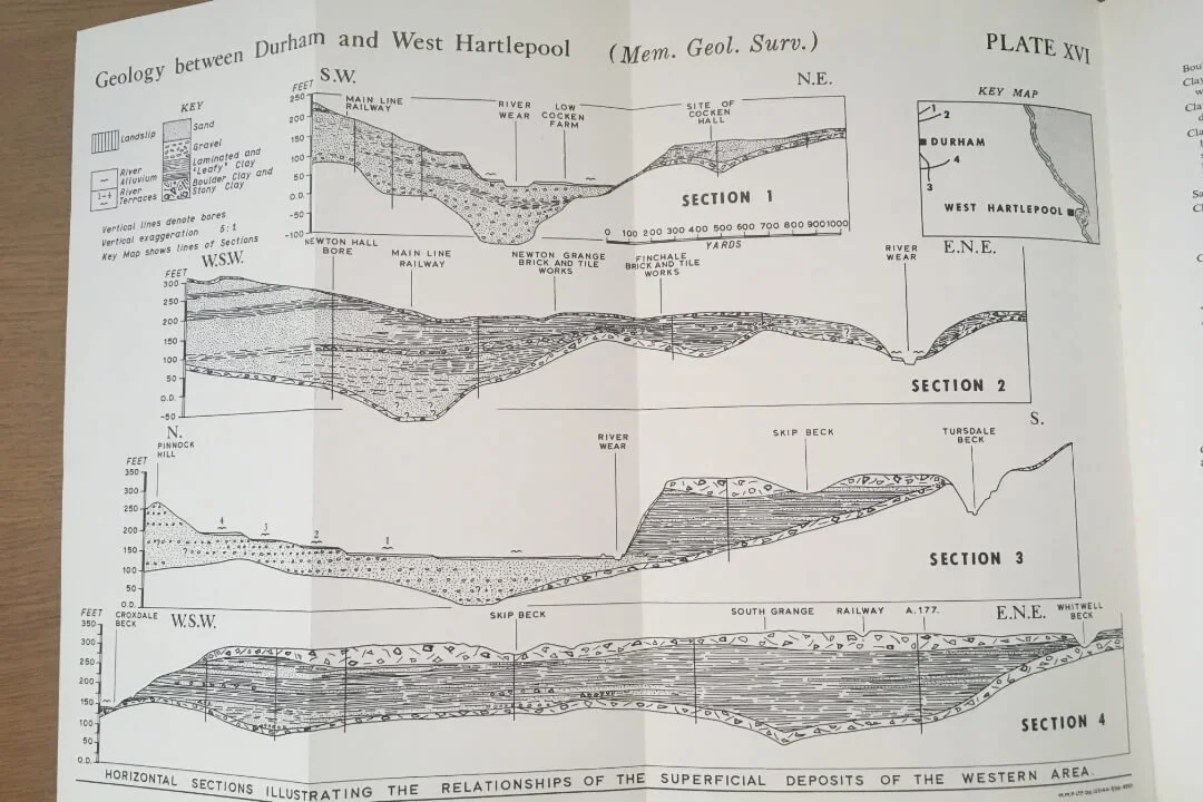
The Initial Geological Review: Mapping and Data Analysis
The first step in any Geological Assessment is a detailed desk-based review. This stage uses historical records, geological mapping, and environmental datasets to build a picture of the site’s subsurface conditions before any intrusive works take place.
At Northpoint, our geologists draw on a wide range of resources, including:
British Geological Survey (BGS) maps and memoirs - to understand soil, rock, and groundwater conditions.
Historic site records and maps - to identify past industrial uses, landfills, or demolition activity.
Geographical Information Systems (GIS) - for layered analysis of hazards, flood risks, and topography.
Mining and mineral extraction records - to highlight potential subsidence risks.
The outcome of this stage is a preliminary ground model. This helps us identify potential geo-hazards, such as unstable soils, contamination, or historic mining, and informs the design of a targeted Phase 2 Ground Investigation.
By investing time in a thorough initial review, developers can avoid unnecessary investigations and focus resources where they are needed most.
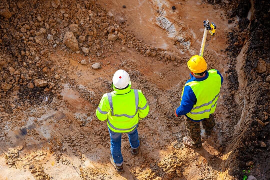
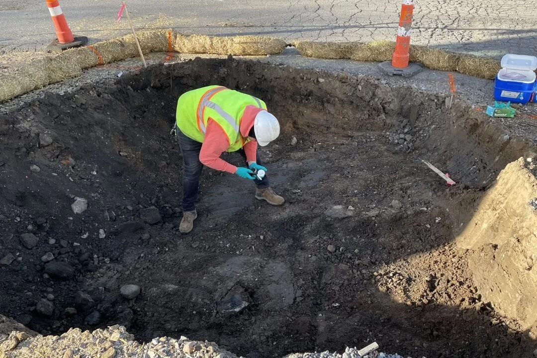
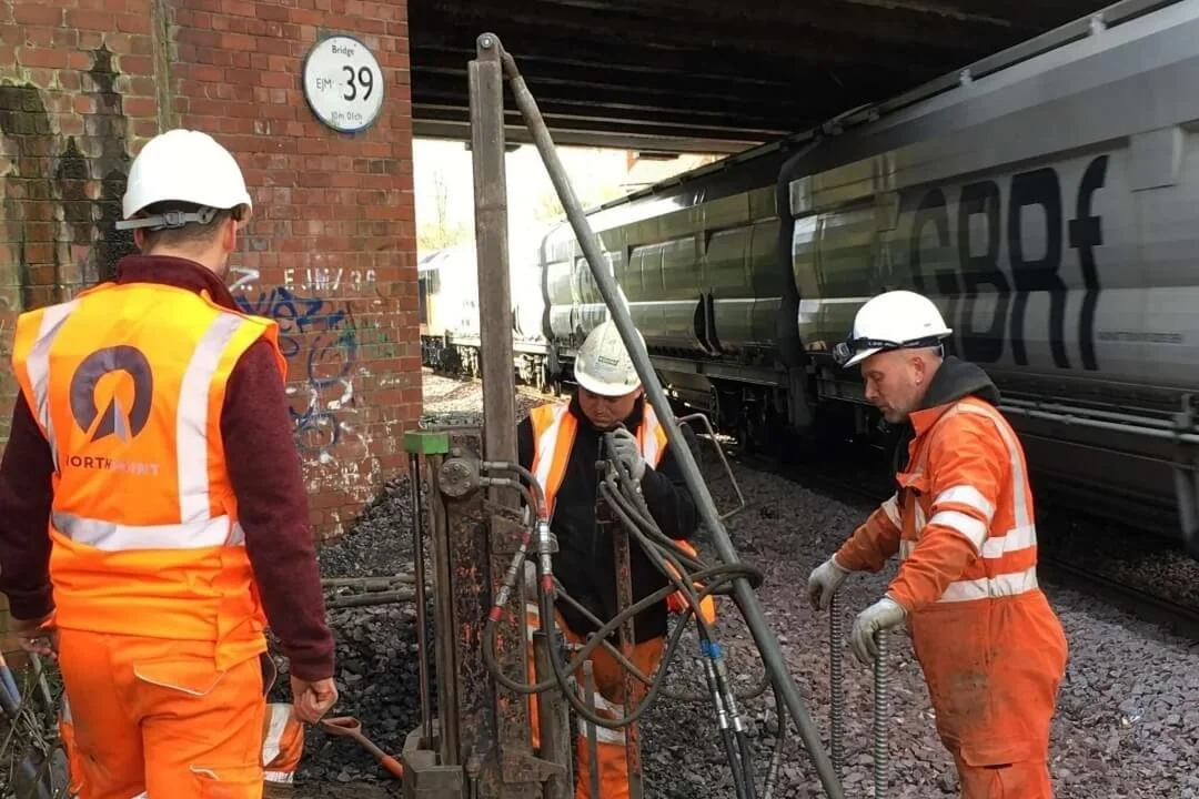
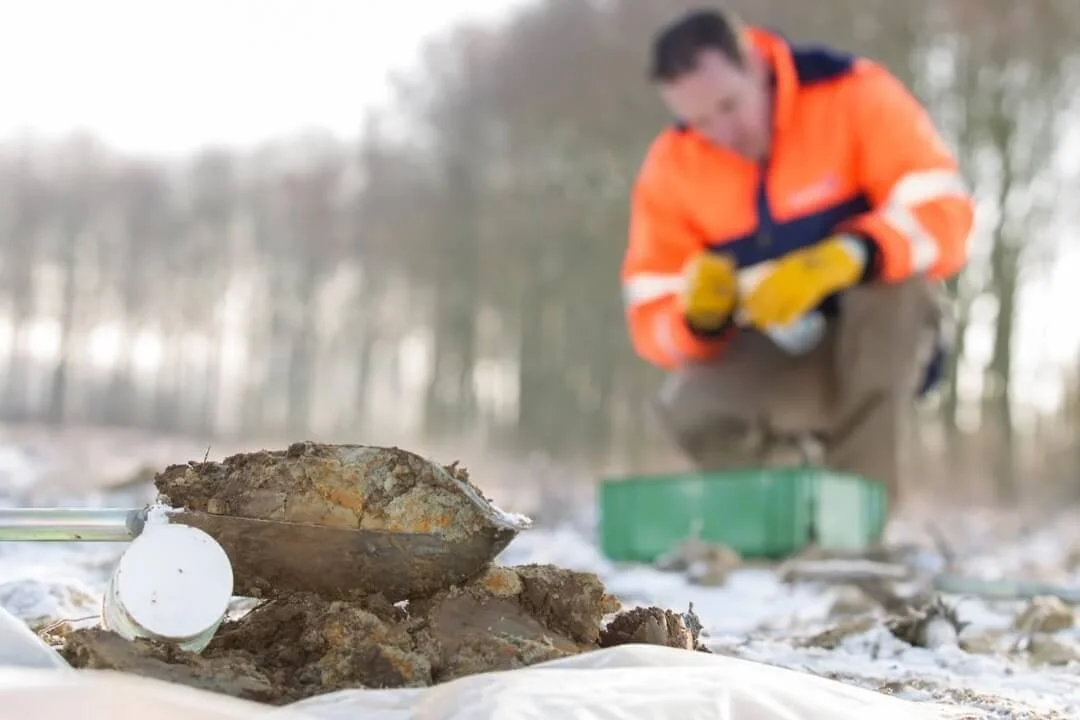
Phase 2 Ground Investigation: Intrusive Works and Soil Testing
Following the desk-based review, a Phase 2 Ground Investigation is carried out to confirm actual ground conditions on site. This stage provides reliable, site-specific data that cannot be obtained from records alone.
Typical intrusive investigation techniques include:
Boreholes and trial pits - to log soil and rock strata in detail.
Soil and groundwater sampling - analysed in accredited laboratories for contamination risks.
In-situ geotechnical testing - such as Standard Penetration Tests (SPTs), permeability tests, or plate load tests.
Groundwater monitoring - to assess seasonal fluctuations and long-term behaviour.
The purpose of this intrusive phase is to verify the desk study findings, quantify risks, and supply engineers with design parameters for foundations, earthworks, and drainage systems.
At Northpoint, all investigations are undertaken in line with British Standards and the guidance of the Association of Geotechnical and Geoenvironmental Specialists (AGS). This ensures results are robust, transparent, and accepted by planning authorities and regulators.
Understanding Ground Conditions and Geological Hazards
A Geological Assessment is not just about collecting data - it’s about interpreting what that data means for development. By analysing soil, rock, and groundwater conditions, geologists can identify geological hazards that may affect construction safety, cost, and long-term performance.
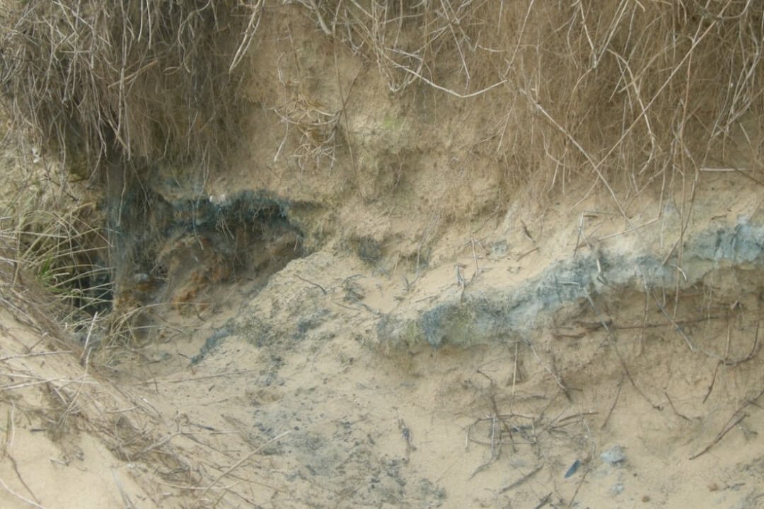
Common hazards uncovered during assessments include:
Unstable soils - such as soft clays or peat that can lead to settlement or structural failure.
Groundwater challenges - high water tables, artesian pressures, or flooding risks.
Contaminated land - from historic industrial activity, landfills, or agricultural chemicals.
Subsidence and sinkholes - linked to soluble rocks, mining voids, or poor ground.
Slope instability - where embankments, cuttings, or natural slopes may fail without reinforcement.
By recognising these risks early, engineers can design tailored solutions such as improved foundations, drainage systems, ground stabilisation, or remediation works. This proactive approach ensures developments are safe, compliant, and cost-effective from the outset.
Mining and Mineral Extraction Risks in the UK
Across many parts of the UK, the legacy of mining and mineral extraction poses significant risks for new developments. Abandoned mine workings, shallow seams, and voids can all lead to ground instability, subsidence, and unexpected structural problems if not identified early.
Key risks include:
Coal mining legacies - particularly across the North East, Midlands, and South Wales coalfields.
Ironstone, chalk, and gypsum extraction - which can leave shallow cavities prone to collapse.
Unrecorded workings - historic mining activity not always documented in public records.

A Geological Assessment includes a detailed review of Coal Authority mining reports, historic maps, and abandonment plans. Where risks are identified, a Coal Mining Risk Assessment (CMRA) and targeted intrusive investigation are carried out to confirm ground stability.
At Northpoint, our geologists regularly manage projects within former coalfield regions and deliver cost-effective solutions that keep developments compliant, safe, and build-ready.
How Geological Assessments Support Planning Applications
For many developments, a Geological Assessment is not just best practice — it’s a requirement. Local planning authorities and regulators often request geological or geoenvironmental reports to demonstrate that a site is safe, suitable, and compliant with environmental standards.
A robust assessment helps:
Secure planning approval - by providing clear evidence of ground conditions and potential risks.
Demonstrate compliance - with the Environment Agency, NHBC, Network Rail, and local authority requirements.
Reduce objections or delays - by addressing contamination, flooding, or mining risks upfront.
Support funding and insurance - as lenders and insurers frequently require geological or risk assessments before approval.
By including detailed mapping, data analysis, and where needed, Coal Mining Risk Assessments or Phase 2 investigations, Northpoint’s reports give planning officers and stakeholders the confidence to progress applications without unnecessary hold-ups.
Northpoint’s Expertise in Geological Assessments
At Northpoint Geotechnical, we combine technical expertise with decades of experience to deliver Geological Assessments that are thorough, practical, and regulator-approved. Our team of engineering geologists and geoenvironmental specialists provide nationwide support for projects of all scales — from small residential sites to major infrastructure schemes.
What sets Northpoint apart:
Integrated services - we deliver the full cycle, from Phase 1 Desk Studies and Geological Assessments through to Phase 2 Ground Investigations, remediation, and design consultancy.
Proven track record - successfully supporting planning approvals and design decisions across housing, commercial, and infrastructure projects.
Regulatory confidence - all reports meet the standards of the Environment Agency, NHBC, Coal Authority, and British Standards.
Client-focused delivery - we tailor every assessment to the unique needs of your site, ensuring cost-effective and build-ready outcomes.
Whether your project involves new housing, brownfield redevelopment, or infrastructure works, Northpoint provides the geological insight needed to de-risk sites and move developments forward with confidence.
When Should You Commission a Geological Assessment?
A Geological Assessment should be carried out at the earliest possible stage of a project to minimise risks and avoid costly surprises later in the development process. In most cases, commissioning the assessment before land purchase or planning submission is the best approach.
Typical situations where a Geological Assessment is required include:
Planning applications - many local authorities mandate assessments for sites with potential environmental or ground risks.
Land acquisition and due diligence - essential for developers and investors before committing to purchase.
Brownfield redevelopment - to assess contamination, historic land use, and unstable ground.
Infrastructure and civil engineering projects - where deep foundations, large structures, or transport links demand detailed geological data.
Sites in former mining areas - to identify risks of subsidence, voids, or hazardous ground conditions.
By commissioning early, you gain a clear understanding of ground risks, support your planning application, and provide engineers with the data needed for safe, efficient design.
Discuss Your Project with Northpoint Geotechnical
If your project requires a Geological Assessment, Desk Study, or Ground Investigation, Northpoint Geotechnical is here to help. Our expert team provides clear, regulator-approved reports that give you the confidence to move forward with planning, design, and construction.
BGA Member · RISQS Verified · Constructionline Gold