
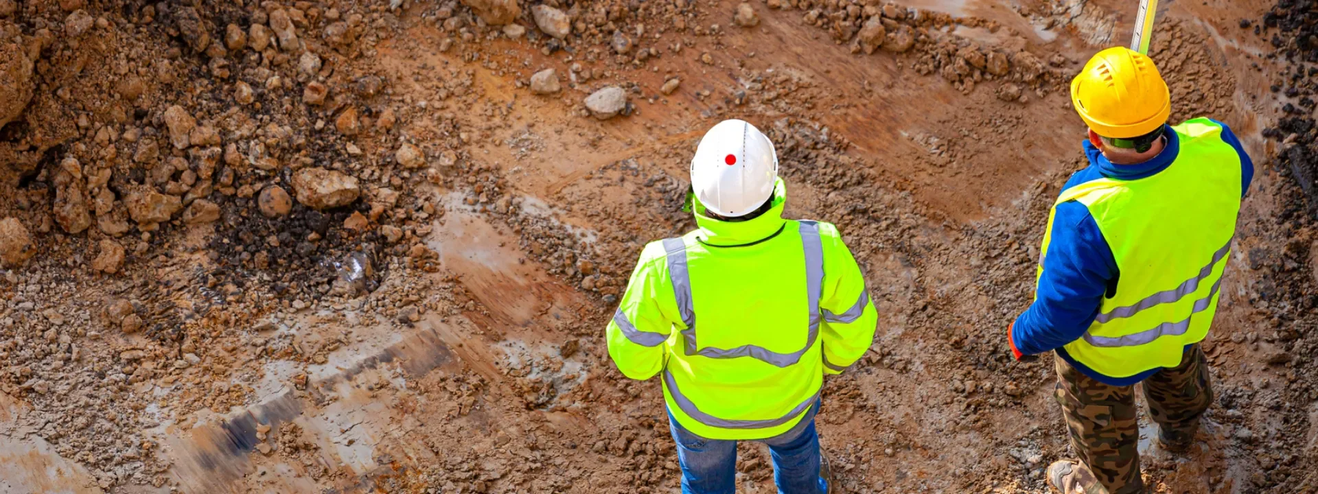
Geotechnical and Geoenvironmental Ground Investigation for Planning and Design
Northpoint provides independent Ground Investigation services for developers, asset owners and project teams across England, Scotland and Wales. Our Phase 2 Site Investigations establish ground conditions and assess the geotechnical and land contamination risks affecting your development.
Building on the findings of a Phase 1 Desk Study and your development proposals, our geotechnical and geoenvironmental engineers design and manage a site-specific investigation. This combines appropriate fieldwork, sampling and laboratory testing, with ground gas and groundwater monitoring where required.
Your Ground Investigation Report explains the findings, their implications and any remaining uncertainties. We provide clear, proportionate recommendations to inform foundation and earthworks design, planning submissions, materials management and the next stages of development.
What Our Phase 2 Site Investigation Includes
Every Northpoint Phase 2 Site Investigation is designed and overseen by experienced Geotechnical and Geoenvironmental Engineers. Each Ground Investigation is tailored to the desk study findings, ground conditions and development proposals, and may include:
-
Non-Intrusive Ground Investigation:
Geophysical surveys, utility mapping and remote sensing help identify subsurface anomalies, voids and obstructions before intrusive works. Where required, specialist Unexploded Ordnance (UXO) assessment informs safe working. These findings help target investigation locations and manage site constraints.
-
Intrusive Ground Investigation:
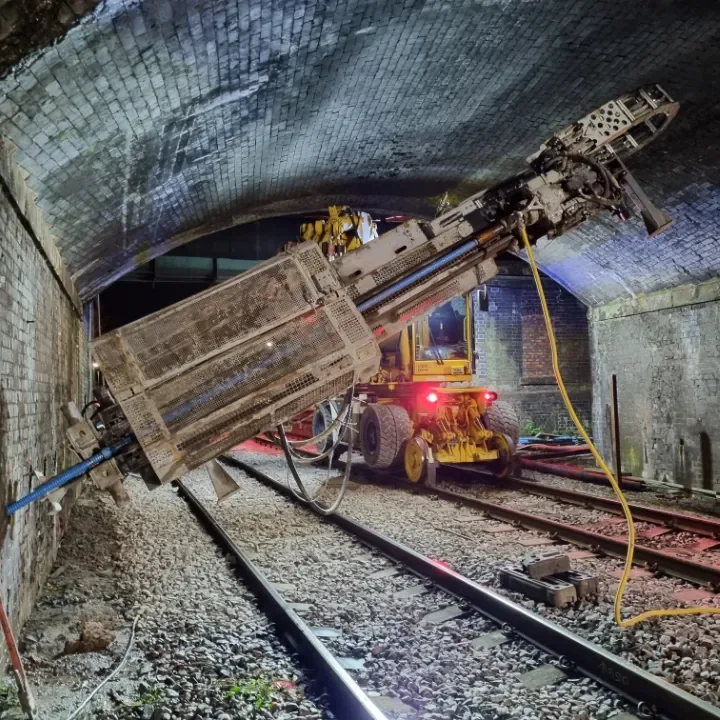
Drilling and excavation provide samples, in-situ data and monitoring installations for design and risk evaluation. Depending on the site, methods may include dynamic or window sampling, rotary, sonic or cable percussion boreholes, cone penetration testing (CPT), excavated trial pits and vacuum excavation.
-
Ground Model Development:
We interpret field, laboratory and monitoring data to develop the geological and hydrogeological ground model. Clear profiles, sections and, where appropriate, 2D or 3D models explain subsurface conditions, groundwater behaviour and remaining uncertainties to support geotechnical and geoenvironmental decisions.
-
Mining Risk Investigation:
Building on a Coal Mining Risk Assessment (CMRA), targeted investigation assesses mining legacy and associated ground instability risks, including suspected shallow workings, mine entries and voids where relevant. Findings inform recommendations aligned with Mining Remediation Authority guidance.
-
Geotechnical Assessment:
Assessment of soil, rock and groundwater conditions provides engineering parameters and recommendations for bearing capacity, settlement, shallow and deep foundations, pavements and earthworks. Foundation zone plans and schedules can be provided for larger developments. Detailed design is supported through our Design Consultancy services.
-
Geoenvironmental Assessment:
We refine the Conceptual Site Model (CSM) and assess human health, controlled waters, ground gas and vapour risks through generic or detailed quantitative risk assessment as required. Reporting follows LCRM, BS 10175 and relevant national guidance. Soil reuse assessment and waste classification inform materials management, disposal costs and proportionate remediation recommendations.
-
Testing & Monitoring:
Site-specific testing may include standard penetration tests (SPT), dynamic probing, CBR, plate load and soakaway or infiltration testing. Laboratory testing assesses soil and rock engineering properties and potential soil and water contaminants, including asbestos where relevant. We use appropriately accredited laboratories, including MCERTS-accredited soil analysis where required. Ground gas, vapour and groundwater monitoring establishes conditions over an appropriate period. Separate waste acceptance criteria (WAC) testing can support landfill disposal where needed.


When Do You Need a Ground Investigation?
A Ground Investigation provides site-specific evidence for planning, design and development decisions. It can be needed on both greenfield and brownfield sites where ground conditions or contamination risks require further assessment.
-
Planning applications and conditions
Provide site-specific geotechnical and land contamination evidence to support planning applications and address relevant conditions. Investigation and reporting are tailored to the development proposals and the reviewing authority’s requirements.
-
Foundation, infrastructure and earthworks design
Establish the ground model and engineering parameters needed to assess bearing capacity, settlement, groundwater conditions and concrete specification requirements. The findings inform foundation options, pavement design and earthworks, helping your designers develop practical, cost-effective solutions.
-
Land and property acquisition
Inform land transactions and technical due diligence by investigating ground-related liabilities, foundation constraints and potential abnormal development costs. This helps your team assess implications for feasibility, purchase decisions and the development programme.
-
Unresolved ground and contamination risks
Confirm or refine risks identified in a Phase 1 Desk Study or previous investigation. Targeted fieldwork, testing and monitoring assess uncertainties associated with variable ground, mining legacy, land contamination, groundwater, ground gas and vapours.
-
Remediation and materials management
Where contamination or ground gas risks are identified, provide the evidence needed to inform proportionate remediation or mitigation. Early soil reuse assessment and waste classification help plan the handling and potential disposal of excavated materials and understand the associated costs.
-
Construction planning and redevelopment
Identify ground-related construction risks and plan works on constrained, urban or operational sites. Investigation findings help your team coordinate excavation, temporary works and any further testing or monitoring, reducing uncertainty, disruption and unexpected ground-related costs.

How the Investigation Works
Northpoint designs and manages each Ground Investigation around your site, development proposals and technical requirements. Our geotechnical and geoenvironmental engineers coordinate the work through four stages, with fieldwork, testing and monitoring overlapping where appropriate.
-
Stage 1: Scope and plan
We review the Phase 1 Desk Study, previous investigation records, development proposals and relevant planning requirements. We agree the investigation objectives, scope, programme and reporting requirements with your project team, taking account of access, utilities, safety and operational constraints.
-
Stage 2: Site investigation
We manage the agreed site works, supervise the investigation, record ground conditions and collect representative samples. Locations and methods are adapted where findings or site constraints require changes, with the reasons, observations and limitations recorded.
-
Stage 3: Testing and monitoring
Samples undergo the specified laboratory testing, alongside relevant in-situ testing and ground gas or groundwater monitoring. Our engineers review results as they become available and identify whether additional information is needed. Monitoring frequency and duration reflect the site risks and assessment requirements.
-
Stage 4: Interpretation and reporting
We interpret the combined evidence to refine the ground model, assess risks and explain the implications for planning, design and construction. Your technically reviewed report distinguishes factual findings from engineering interpretation and sets out clear conclusions, remaining uncertainties and proportionate recommendations.
What Your Ground Investigation Report Contains
Your report explains what the investigation found, what it means for your development and the recommended next steps. Content and digital outputs reflect the agreed investigation scope, with factual records and interpretation clearly distinguished.
-
Executive summary: The investigation objectives, principal findings and implications for your proposed development.
-
Factual investigation records: Location plans, borehole and trial pit logs, field observations, test results, laboratory certificates and monitoring records.
-
Refined ground model: Ground profiles and sections explaining soil, rock and groundwater conditions, their variation across the site and remaining uncertainties.
-
Geotechnical design inputs: Engineering parameters and recommendations for foundation options, bearing capacity, settlement, pavements, earthworks, groundwater and concrete specification requirements.
-
Land contamination risk assessment: An updated Conceptual Site Model and appropriate quantitative assessment of risks to human health and the water environment, including ground gas and vapours where relevant.
-
Materials management implications: Soil reuse and waste classification findings, where undertaken, to inform materials handling, potential reuse, disposal routes and cost planning.
-
Conclusions and next steps: Recommendations for further investigation, monitoring, remediation or mitigation, with assessment limitations and remaining uncertainties clearly identified.
-
Digital ground data: AGS outputs and other agreed digital formats to support your project team’s ground modelling and design workflows.

Why Choose Northpoint for Your Site Investigation?
-
Independent specialist advice
Direct access to experienced geotechnical and geoenvironmental engineers providing independent advice for your development.
-
Targeted investigation
Site-specific scopes focus drilling, testing and monitoring on relevant risks, avoiding unnecessary work and expenditure.
-
Integrated technical assessment
We review geotechnical and contamination findings together and provide practical recommendations. Reporting aligns with BS 5930, Eurocode 7, BS 10175 and Land Contamination Risk Management (LCRM) guidance, as applicable.
-
Complex-site experience
Coordinated investigation on constrained, urban and operational sites, supported by nationwide mobilisation and trusted specialist partners.
-
Usable digital ground data
AGS outputs and agreed digital formats help your civil and structural design teams use investigation findings efficiently.
-
Clear costs and continuing support
Defined scopes, transparent costs and agreed programmes, with continuing support through design, remediation and verification.
Ground Investigation Project Experience
Examples of Northpoint Ground Investigation projects supporting residential redevelopment, infrastructure and rail, with findings used to inform design, assess contamination risks and plan construction.
-
Central Park, Darlington
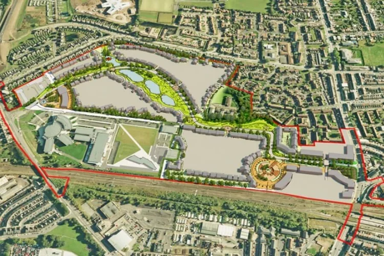
Variable Made Ground and known contamination hotspots required targeted investigation for a proposed access road. Trial pits, dynamic sampling and laboratory testing informed pavement design, contamination assessment and the management of excavated materials.
View case study -
Gresham Development, Middlesbrough
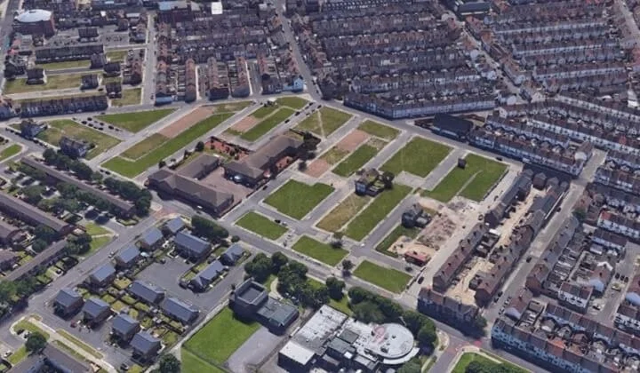
Legacy demolition materials and differing foundation loads needed assessment for a proposed 179-home development. Boreholes, trial pits and testing provided the ground model and risk assessment needed to inform foundation selection and planning submissions.
View case study -

Barracks Rail Crossing, Perthshire
A new rail crossing required investigation in a remote location beside an operational railway. Rotary boreholes and geological logging provided ground profiles and engineering parameters to inform foundation design.
View case study
Phase 2 Site & Ground Investigation FAQs
What is a Phase 2 Site Investigation and how does it differ from Phase 1?
A Phase 2 Site Investigation, also described as a Phase II Site Investigation, gathers new information about soil, rock and groundwater conditions and potential contamination. It can combine geotechnical and geoenvironmental requirements within one coordinated Ground Investigation.
A Phase 1 Desk Study reviews existing information and site observations to identify potential risks. Phase 2 uses targeted fieldwork, sampling, testing and monitoring to investigate those risks and obtain the information needed for design.
Is a Ground Investigation the same as a Site Investigation?
Site Investigation is the wider process of understanding a site, including desk studies, walkovers and assessment of development constraints. Ground Investigation focuses on investigating the ground itself through methods such as boreholes, trial pits, geophysics, testing and monitoring. The terms are often used interchangeably when commissioning intrusive investigation.
Ground Investigation can be needed on both greenfield and brownfield sites to obtain engineering parameters or assess potential contamination and other ground risks.
How do you decide the methods, number, location and depth of tests?
Our geotechnical and geoenvironmental engineers design the investigation around the Phase 1 findings, existing records and proposed development. We consider expected ground conditions, structural loads, potential contamination sources and site access. Sampling and testing target the information needed for design and risk assessment, with the scope reviewed as findings become available.
Can you work from another consultant’s desk study or previous investigation?
Yes. We review existing reports for their scope, date, data quality, coverage and relevance to the current proposals. Suitable information can inform the investigation, with additional work targeted at gaps or unresolved risks. We also consider any restrictions on relying on or reusing the original reports.
What permissions and safety measures are needed?
We coordinate site access, landowner liaison, relevant permits and site-specific Safe Systems of Work, risk assessments and method statements. Utility information, surveying and verification inform safe investigation locations, with PAS 128 surveys specified where appropriate.
Traffic management and rail possession arrangements are incorporated where required. Working areas, access restrictions, operational requirements and reinstatement are agreed before mobilisation to help minimise disruption.
Do I need ground gas, vapour or groundwater monitoring?
Monitoring is included where the site conditions, potential risks or design requirements justify it. Ground gas and vapour monitoring help assess risks to buildings and occupants; groundwater monitoring can support contamination assessment and provide information for foundation or excavation design.
We specify monitoring methods, frequency and duration around the conceptual model, site conditions and relevant guidance. Findings during the investigation can identify additional monitoring needs.
How long does a Phase 2 Site Investigation take?
Fieldwork duration depends on the scope, access and investigation methods. Preliminary findings are typically issued within 72 hours of fieldwork completion. Laboratory testing commonly takes around two weeks, with final interpretative reporting typically taking two to three weeks once the necessary testing and monitoring results are available.
Where gas or groundwater monitoring is required, the programme may extend over one to three months or longer, depending on site conditions and assessment requirements. We agree the programme and reporting milestones with your project team before starting.
How much does a Ground Investigation cost, and how do you control the budget?
Costs depend on the investigation objectives, methods, locations and depths, site access, laboratory testing, monitoring and reporting requirements. Northpoint provides a clearly defined, fixed-scope proposal, with options to phase works around technical priorities and available budgets.
Risk-led scoping and suitable investigation methods help avoid unnecessary work. Any proposed scope changes and their cost or programme implications are discussed with your project team.
What will I receive from Northpoint?
We provide factual and interpretative reporting suited to the agreed brief, including a Ground Investigation Report (GIR) where required. Deliverables include relevant site records, logs, test and monitoring results, a refined ground model, engineering parameters, contamination assessment and clear recommendations.
Reports are provided digitally, with AGS ground data and other supporting formats agreed to suit your project team’s requirements.
Will the report satisfy planners, lenders and designers?
We agree the intended use and review relevant planning, lender and design requirements at instruction. Reporting is aligned with BS 5930, Eurocode 7, BS 10175 and LCRM as applicable, taking account of the regulatory context in the relevant UK nation.
Acceptance depends on the agreed scope, findings, reliance arrangements and the reviewing authority or organisation. Further investigation, assessment or mitigation may be needed to address outstanding requirements.
What information do you need to prepare a quotation?
Please provide the site address and boundary plan, development proposals, relevant planning conditions and any existing desk studies or investigation reports. Proposed layouts, structural loads, utilities information, access restrictions and your required programme are useful where available. We confirm any additional information needed to define the scope and arrange the works.
What happens if contamination or unsuitable ground is found?
We assess the findings in the context of the proposed development and explain the implications for risk, design and construction. Recommendations may include further investigation, additional risk assessment, changes to foundation or earthworks proposals, or remediation and protective measures where needed.
Northpoint can continue supporting the project through geotechnical design and remediation and verification, with the scope defined around the investigation findings.
Related Ground Investigation Guidance
Practical guidance on intrusive site investigation, geological assessment and the desk study evidence used to plan appropriate fieldwork.
-
What Is a Phase 2 Intrusive Site Investigation?
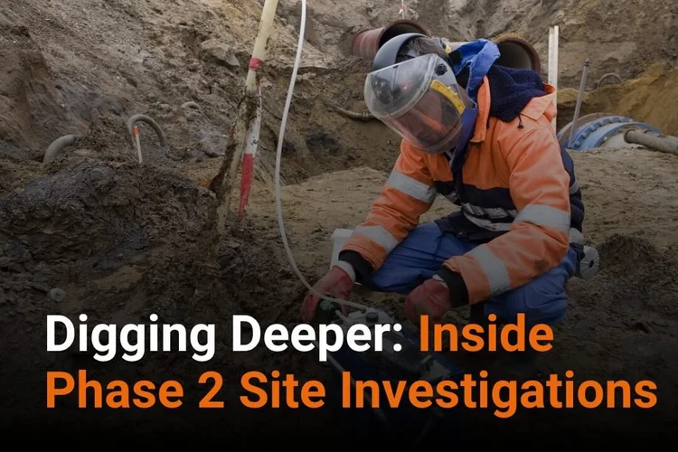
Understand how intrusive fieldwork, laboratory testing and monitoring inform geotechnical design and land contamination assessment.
-
The Importance of a Geological Assessment
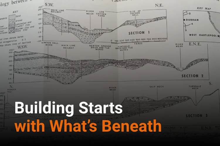
Explore how geological information and site investigation identify ground hazards and provide evidence for foundations, earthworks and drainage.
-

What Is Involved with a Desk Study Report?
See how a Phase 1 Desk Study identifies potential risks and helps define the scope of a targeted Ground Investigation.